
GIS Services
Anding Environmental has over a decade of experience in GIS and GPS mapping. No matter how large or small, we can provide high quality maps and GIS databases for your projects.
GIS Mapping
GIS technology has become the most comprehensive tool for spatial data management and presentation, leading the way for informed project decision making. Anding Environmental provides expert GIS consulting, offering a variety of GIS services to meet our clients' needs. This includes tasks such as static map creation, a variety of data management and creation tasks, and spatial analysis.
GIS technology can be used in both the planning and execution of your projects. High quality, custom maps are also very powerful marketing tools, especially for real estate brokers and commercial developers.
GIS Services include:
- Consulting Services
- Spatial Analysis
- GeoDatabase setup/prep
- High Quality Static Maps/ Wall Maps
- Parcel Mapping
- GIS Maintenance
- GIS Conversions
- Raster to Vector/ Vector to Raster
- Training and Support
- Digital Imagery
Examples of different types of mapping and data which can be developed are:
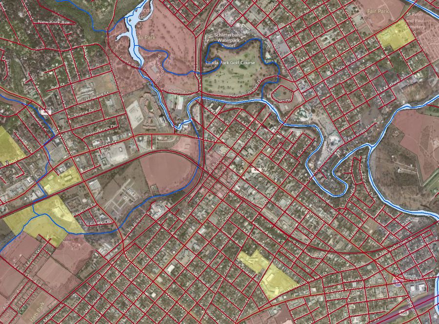
- Location and Site Location Analysis
- Time Period Comparison (Current and Historical Aerials, Infrastructure, etc.)
- Zoning
- Easements
- Current and Historical Land Use
- Surrounding Area Property Ownership Data (owner, acreage, legal description, appraisal value, etc.)
- Demographic Statistics
- Area Growth Predictions
- Utilities and Infrastructure
- Site Topography and Digital Elevation Models
- Water Features and Flood Zones
- Soil Types and Vegetation/Habitat Analysis
- Geologic and Karst Assessments
Ask about our custom "Map Packages" specifically designed for real estate brokers needing an edge for property transactions. Provide your clients with high quality map packages for your property that detail every aspect of the site (location, aerials, topography, zoning, utilities, etc.).
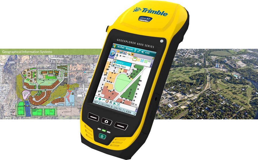
GPS Mapping
- GIS/GPS Mapping Services
- GPS Field Inventory
- Property Lines and Boundary Maintenance
- Habitat Delineation
- Utility Mapping
- Golf Course Mapping
- Ranch Mapping
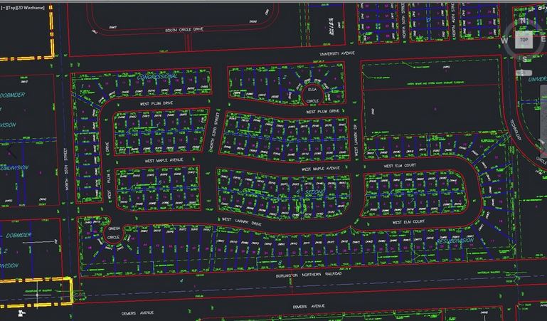
Drafting/ Computer Aided Design (CAD)
Anding Environmental also offers basic drafting and CAD services to assist with your projects. Contact us now to discuss your needs.